
Thank you for supporting this site ❤️
Make a donation
Make a donation
Milford topographic map
Click on the map to display elevation.
Thank you for supporting this site ❤️
Make a donation
Make a donation
About this map
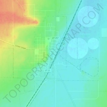
Name: Milford topographic map, elevation, terrain.
Location: Milford, Beaver County, Utah, 84751, United States (38.38261 -113.03766 38.40810 -112.99127)
Average elevation: 1,525 m
Minimum elevation: 1,509 m
Maximum elevation: 1,559 m
Thank you for supporting this site ❤️
Make a donation
Make a donation
Other topographic maps
Click on a map to view its topography, its elevation and its terrain.