
Thank you for supporting this site ❤️
Make a donation
Make a donation
Dead Horse Point topographic map
Click on the map to display elevation.
Thank you for supporting this site ❤️
Make a donation
Make a donation
About this map
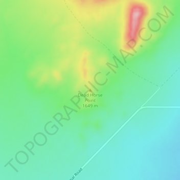
Name: Dead Horse Point topographic map, elevation, terrain.
Location: Dead Horse Point, Beaver County, Utah, United States (38.22353 -113.23418 38.22363 -113.23408)
Average elevation: 1,615 m
Minimum elevation: 1,562 m
Maximum elevation: 1,733 m
Thank you for supporting this site ❤️
Make a donation
Make a donation
Other topographic maps
Click on a map to view its topography, its elevation and its terrain.