
Thank you for supporting this site ❤️
Make a donation
Make a donation
Rhodhiss topographic map
Click on the map to display elevation.
Thank you for supporting this site ❤️
Make a donation
Make a donation
About this map
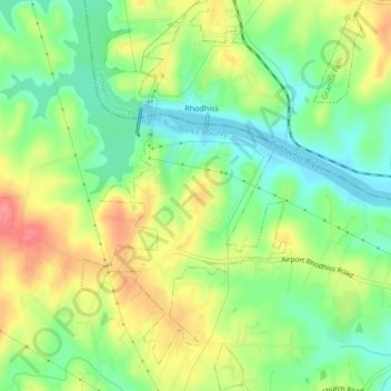
Name: Rhodhiss topographic map, elevation, terrain.
Location: Rhodhiss, Burke County, North Carolina, 28667, United States (35.74904 -81.44428 35.78352 -81.42069)
Average elevation: 320 m
Minimum elevation: 286 m
Maximum elevation: 363 m
Thank you for supporting this site ❤️
Make a donation
Make a donation
Other topographic maps
Click on a map to view its topography, its elevation and its terrain.
Thank you for supporting this site ❤️
Make a donation
Make a donation
Thank you for supporting this site ❤️
Make a donation
Make a donation
Morganton
United States > North Carolina > Burke County > Morganton > Morganton
Average elevation: 339 m
Thank you for supporting this site ❤️
Make a donation
Make a donation