
Thank you for supporting this site ❤️
Make a donation
Make a donation
Lakeside topographic map
Click on the map to display elevation.
Thank you for supporting this site ❤️
Make a donation
Make a donation
About this map
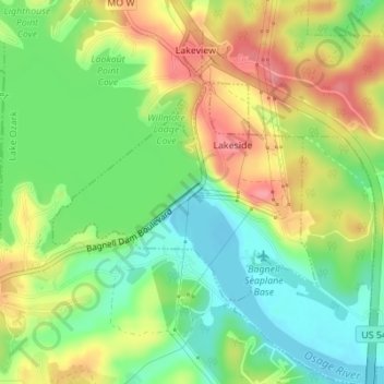
Name: Lakeside topographic map, elevation, terrain.
Location: Lakeside, Miller County, Missouri, United States (38.19685 -92.63576 38.21215 -92.61191)
Average elevation: 209 m
Minimum elevation: 170 m
Maximum elevation: 256 m
Thank you for supporting this site ❤️
Make a donation
Make a donation
Other topographic maps
Click on a map to view its topography, its elevation and its terrain.