Geolocate

Steinbach topographic map

Interactive map

Click on the map to display elevation.

About this map

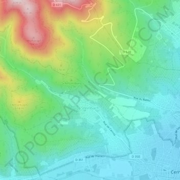
Name: Steinbach topographic map, elevation, terrain.

Location: Steinbach, Thann-Guebwiller, Haut-Rhin, Grand Est, France métropolitaine, 68700, France (47.80796 7.11367 47.84105 7.16555)

Average elevation: 441 m

Minimum elevation: 295 m

Maximum elevation: 812 m

Other topographic maps

Click on a map to view its topography, its elevation and its terrain.

Jebsheim

France > Grand Est > Haut-Rhin

Jebsheim, Colmar-Ribeauvillé, Haut-Rhin, Grand Est, France métropolitaine, 68320, France

Average elevation: 182 m

Munster

France > Grand Est > Haut-Rhin

Munster, Colmar-Ribeauvillé, Haut-Rhin, Grand Est, France métropolitaine, 68140, France

Average elevation: 529 m

Folgensbourg

France > Grand Est > Haut-Rhin > Folgensbourg

Folgensbourg, Mulhouse, Haut-Rhin, Grand Est, France métropolitaine, 68220, France

Average elevation: 439 m

Mittlach

France > Grand Est > Haut-Rhin

Mittlach, Colmar-Ribeauvillé, Haut-Rhin, Grand Est, France métropolitaine, 68380, France

Average elevation: 862 m

Stosswihr

France > Grand Est > Haut-Rhin

Stosswihr, Colmar-Ribeauvillé, Haut-Rhin, Grand Est, France métropolitaine, 68140, France

Average elevation: 708 m

Kembs

France > Grand Est > Haut-Rhin

Kembs, Mulhouse, Haut-Rhin, Grand Est, France métropolitaine, 68680, France

Average elevation: 263 m

Guémar

France > Grand Est > Haut-Rhin > Guémar

Guémar, Colmar-Ribeauvillé, Haut-Rhin, Grand Est, France métropolitaine, 68970, France

Average elevation: 190 m