
Yayla Gökben topographic map
Interactive map
Click on the map to display elevation.
About this map
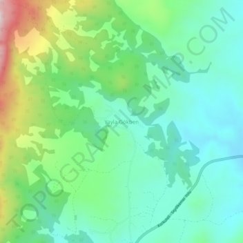
Name: Yayla Gökben topographic map, elevation, terrain.
Location: Yayla Gökben, Seydikemer, Muğla, Aegean Region, Turkey (36.87802 29.60880 36.91802 29.64880)
Average elevation: 1,390 m
Minimum elevation: 1,241 m
Maximum elevation: 1,770 m
Other topographic maps
Click on a map to view its topography, its elevation and its terrain.
Yayla Patlangıç
Yayla Patlangıç, Seydikemer, Muğla, Aegean Region, Turkey
Average elevation: 1,172 m