
Thank you for supporting this site ❤️
Make a donation
Make a donation
Davenport topographic map
Click on the map to display elevation.
Thank you for supporting this site ❤️
Make a donation
Make a donation
About this map
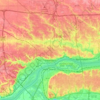
Name: Davenport topographic map, elevation, terrain.
Location: Davenport, Scott County, Iowa, United States (41.46063 -90.68793 41.62029 -90.49082)
Average elevation: 205 m
Minimum elevation: 157 m
Maximum elevation: 237 m
Thank you for supporting this site ❤️
Make a donation
Make a donation
Other topographic maps
Click on a map to view its topography, its elevation and its terrain.