
Madison County topographic map
Interactive map
Click on the map to display elevation.
About this map
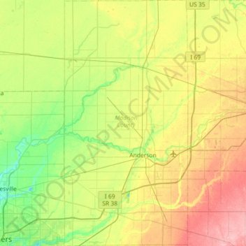
Name: Madison County topographic map, elevation, terrain.
Location: Madison County, Indiana, United States of America (39.94364 -85.86302 40.37939 -85.57628)
Average elevation: 270 m
Minimum elevation: 230 m
Maximum elevation: 336 m
Other topographic maps
Click on a map to view its topography, its elevation and its terrain.
Buddha
United States of America > Indiana > Buddha
Buddha, Lawrence County, Indiana, United States of America
Average elevation: 182 m
Bloomington
United States of America > Indiana > Bloomington
Bloomington, Monroe County, Indiana, United States of America
Average elevation: 241 m