
Faisaliah Sub-District topographic map
Interactive map
Click on the map to display elevation.
About this map
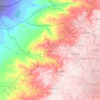
Name: Faisaliah Sub-District topographic map, elevation, terrain.
Average elevation: 485 m
Minimum elevation: -205 m
Maximum elevation: 861 m
Other topographic maps
Click on a map to view its topography, its elevation and its terrain.
Mlaih Sub-District
Mlaih Sub-District, Dieban District, Madaba, Jordan
Average elevation: 663 m