
Thank you for supporting this site ❤️
Make a donation
Make a donation
Carlsberg topographic map
Click on the map to display elevation.
Thank you for supporting this site ❤️
Make a donation
Make a donation
Carlsberg
The municipality lies at the north edge of the Palatinate Forest between the Haardt range in the south and the Autobahn A 6 in the north in the Leiningerland at an elevation of 285 m above sea level. Carlsberg belongs to the Verbandsgemeinde of Leiningerland, whose seat is in Grünstadt.
Thank you for supporting this site ❤️
Make a donation
Make a donation
About this map
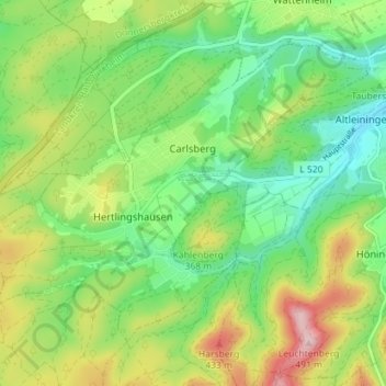
Name: Carlsberg topographic map, elevation, terrain.
Average elevation: 327 m
Minimum elevation: 238 m
Maximum elevation: 476 m
Thank you for supporting this site ❤️
Make a donation
Make a donation
Other topographic maps
Click on a map to view its topography, its elevation and its terrain.