
Thank you for supporting this site ❤️
Make a donation
Make a donation
Methil topographic map
Click on the map to display elevation.
Thank you for supporting this site ❤️
Make a donation
Make a donation
About this map
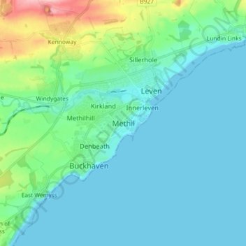
Name: Methil topographic map, elevation, terrain.
Location: Methil, Fife, Scotland, KY8 3HN, United Kingdom (56.14488 -3.05326 56.22488 -2.97326)
Average elevation: 26 m
Minimum elevation: 0 m
Maximum elevation: 155 m
Thank you for supporting this site ❤️
Make a donation
Make a donation
Other topographic maps
Click on a map to view its topography, its elevation and its terrain.