
Thank you for supporting this site ❤️
Make a donation
Make a donation
Röhrmoos topographic map
Click on the map to display elevation.
Thank you for supporting this site ❤️
Make a donation
Make a donation
About this map
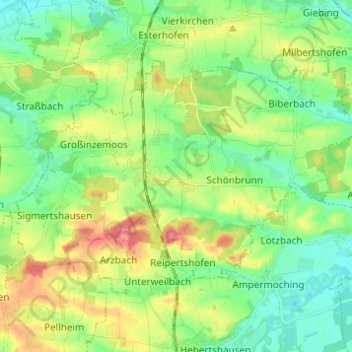
Name: Röhrmoos topographic map, elevation, terrain.
Location: Röhrmoos, Landkreis Dachau, Bavaria, 85244, Germany (48.30268 11.39791 48.35685 11.52042)
Average elevation: 489 m
Minimum elevation: 462 m
Maximum elevation: 537 m
Thank you for supporting this site ❤️
Make a donation
Make a donation
Other topographic maps
Click on a map to view its topography, its elevation and its terrain.