
Pengjiang District topographic map
Interactive map
Click on the map to display elevation.
About this map
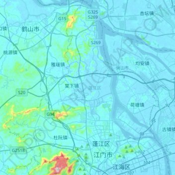
Name: Pengjiang District topographic map, elevation, terrain.
Location: Pengjiang District, Jiangmen, Guangdong Province, China (22.55170 112.91174 22.81046 113.16526)
Average elevation: 22 m
Minimum elevation: -11 m
Maximum elevation: 525 m
Other topographic maps
Click on a map to view its topography, its elevation and its terrain.
Taishan
China > Guangdong Province > Jiangmen
Taishan, Jiangmen, Guangdong Province, China
Average elevation: 42 m