
Thank you for supporting this site ❤️
Make a donation
Make a donation
Chlef topographic map
Click on the map to display elevation.
Thank you for supporting this site ❤️
Make a donation
Make a donation
About this map
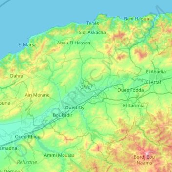
Name: Chlef topographic map, elevation, terrain.
Location: Chlef, Algeria (35.85122 0.69084 36.55563 1.72062)
Average elevation: 328 m
Minimum elevation: 0 m
Maximum elevation: 1,959 m
Thank you for supporting this site ❤️
Make a donation
Make a donation
Other topographic maps
Click on a map to view its topography, its elevation and its terrain.
Thank you for supporting this site ❤️
Make a donation
Make a donation
Thank you for supporting this site ❤️
Make a donation
Make a donation