
Marion County topographic map
Interactive map
Click on the map to display elevation.
About this map
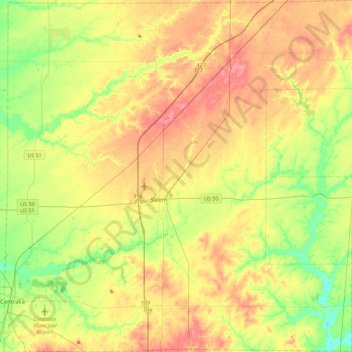
Name: Marion County topographic map, elevation, terrain.
Location: Marion County, Illinois, USA (38.47414 -89.14445 38.82556 -88.69620)
Average elevation: 163 m
Minimum elevation: 128 m
Maximum elevation: 200 m
Other topographic maps
Click on a map to view its topography, its elevation and its terrain.
Naperville
USA > Illinois > Naperville
Naperville, DuPage County, Illinois, USA
Average elevation: 214 m
Garfield Ridge
Garfield Ridge, Chicago, Cook County, Illinois, USA
Average elevation: 184 m
Montague Island
Montague Island, Rockford, Winnebago County, Illinois, 61104, USA
Average elevation: 254 m
Mount Carmel
USA > Illinois > Mount Carmel
Mount Carmel, Wabash County, Illinois, USA
Average elevation: 128 m