
Thank you for supporting this site ❤️
Make a donation
Make a donation
Kingman County topographic map
Click on the map to display elevation.
Thank you for supporting this site ❤️
Make a donation
Make a donation
About this map
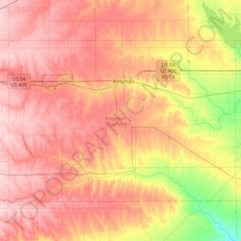
Name: Kingman County topographic map, elevation, terrain.
Location: Kingman County, Kansas, United States (37.38406 -98.46677 37.73454 -97.80672)
Average elevation: 480 m
Minimum elevation: 387 m
Maximum elevation: 550 m
Thank you for supporting this site ❤️
Make a donation
Make a donation
Other topographic maps
Click on a map to view its topography, its elevation and its terrain.