
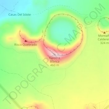
Caldera Blanca topographic map
Interactive map
Click on the map to display elevation.
About this map
Name: Caldera Blanca topographic map, elevation, terrain.
Location: Caldera Blanca, Tinajo, Las Palmas, Îles Canaries, Espagne (29.03436 -13.73180 29.03446 -13.73170)
Average elevation: 245 m
Minimum elevation: 90 m
Maximum elevation: 456 m
Other topographic maps
Click on a map to view its topography, its elevation and its terrain.