
Tinajo topographic map
Interactive map
Click on the map to display elevation.
About this map
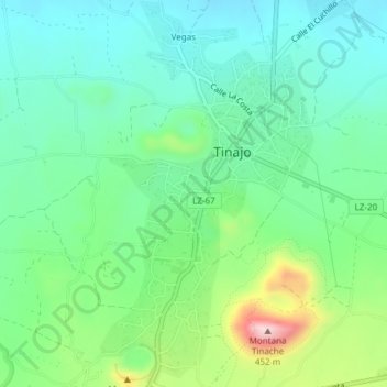
Name: Tinajo topographic map, elevation, terrain.
Location: Tinajo, Las Palmas, Îles Canaries, 35560, Espagne (29.04658 -13.68907 29.07943 -13.66827)
Average elevation: 208 m
Minimum elevation: 117 m
Maximum elevation: 446 m
Other topographic maps
Click on a map to view its topography, its elevation and its terrain.
Caldera Blanca
Caldera Blanca, Tinajo, Las Palmas, Îles Canaries, Espagne
Average elevation: 245 m