
Tunkás topographic map
Interactive map
Click on the map to display elevation.
About this map
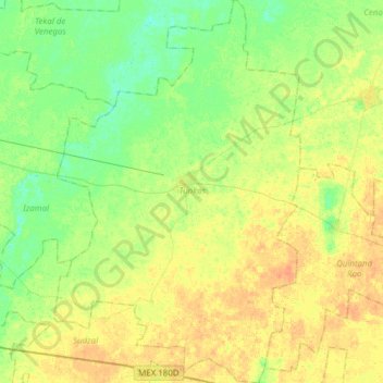
Name: Tunkás topographic map, elevation, terrain.
Location: Tunkás, Yucatán, México (20.75231 -88.85724 21.03963 -88.65939)
Average elevation: 19 m
Minimum elevation: 6 m
Maximum elevation: 31 m
Other topographic maps
Click on a map to view its topography, its elevation and its terrain.