
Kodiyat topographic map
Interactive map
Click on the map to display elevation.
About this map
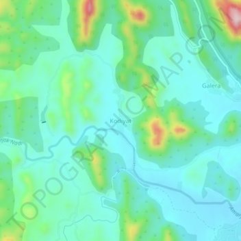
Name: Kodiyat topographic map, elevation, terrain.
Location: Kodiyat, Girwa Tehsil, Udaipur District, Rajasthan, India (24.56243 73.59290 24.60243 73.63290)
Average elevation: 672 m
Minimum elevation: 606 m
Maximum elevation: 908 m
Other topographic maps
Click on a map to view its topography, its elevation and its terrain.
Udaipur
India > Rajasthan > Girwa Tehsil
Udaipur, Girwa Tehsil, Udaipur District, Rajasthan, 313001, India
Average elevation: 656 m
Kalarwas
India > Rajasthan > Girwa Tehsil
Kalarwas, Girwa Tehsil, Udaipur District, Rajasthan, India
Average elevation: 583 m
Pratap Park
India > Rajasthan > Girwa Tehsil > Udaipur
Pratap Park, Udaipur, Girwa Tehsil, Udaipur District, Rajasthan, 313001, India
Average elevation: 608 m