
Thank you for supporting this site ❤️
Make a donation
Make a donation
Michigan City topographic map
Click on the map to display elevation.
Thank you for supporting this site ❤️
Make a donation
Make a donation
About this map
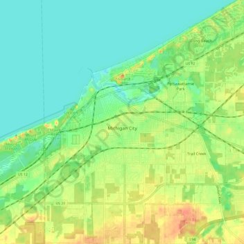
Name: Michigan City topographic map, elevation, terrain.
Location: Michigan City, LaPorte County, Indiana, United States (41.66581 -86.93268 41.75345 -86.81609)
Average elevation: 188 m
Minimum elevation: 172 m
Maximum elevation: 212 m
Thank you for supporting this site ❤️
Make a donation
Make a donation
Other topographic maps
Click on a map to view its topography, its elevation and its terrain.