
Thank you for supporting this site ❤️
Make a donation
Make a donation
Burien topographic map
Click on the map to display elevation.
Thank you for supporting this site ❤️
Make a donation
Make a donation
About this map
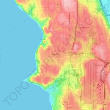
Name: Burien topographic map, elevation, terrain.
Location: Burien, King County, Washington, United States (47.43121 -122.40766 47.50709 -122.29246)
Average elevation: 65 m
Minimum elevation: -1 m
Maximum elevation: 148 m
Thank you for supporting this site ❤️
Make a donation
Make a donation
Other topographic maps
Click on a map to view its topography, its elevation and its terrain.