
Thank you for supporting this site ❤️
Make a donation
Make a donation
Lochcarron topographic map
Click on the map to display elevation.
Thank you for supporting this site ❤️
Make a donation
Make a donation
About this map
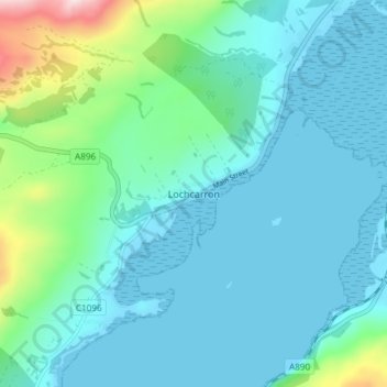
Name: Lochcarron topographic map, elevation, terrain.
Location: Lochcarron, Highland, Scotland, IV54 8YD, United Kingdom (57.38010 -5.51302 57.42010 -5.47302)
Average elevation: 67 m
Minimum elevation: -1 m
Maximum elevation: 405 m
Thank you for supporting this site ❤️
Make a donation
Make a donation
Other topographic maps
Click on a map to view its topography, its elevation and its terrain.