
Comarca Los Amadores Ubú Norte topographic map
Interactive map
Click on the map to display elevation.
About this map
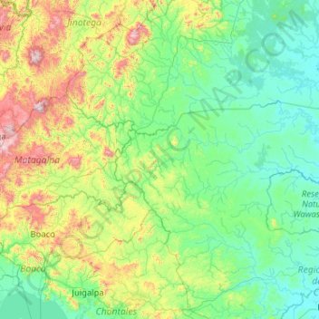
Name: Comarca Los Amadores Ubú Norte topographic map, elevation, terrain.
Average elevation: 252 m
Minimum elevation: 0 m
Maximum elevation: 1,652 m
Other topographic maps
Click on a map to view its topography, its elevation and its terrain.
Managua
Managua's city area extends about 544 square kilometers (210 square miles), essentially south from the south shore of Lake Managua. The lakeshore is at an altitude of 55 meters (180 feet) above sea level, and the city climbs as it gets towards the Sierras de Managua further south where it is over 700 meters…
Average elevation: 223 m
Jinotega
The city of Jinotega "Las Brumas" is the departmental capital of the homonymous department with an urban population of 53 265 inhabitants in the year 2017. It is located in a valley at an altitude of 1,003.87 meters above sea level with a cool climate at an average temperature of 25 °C and a distance of 142…
Average elevation: 524 m