
Sumbawanga topographic map
Interactive map
Click on the map to display elevation.
About this map
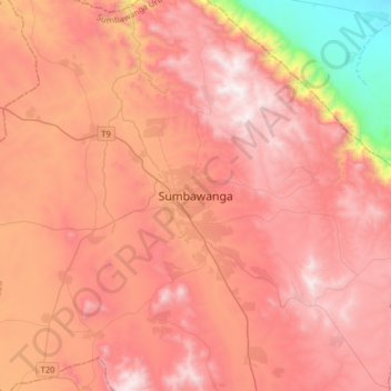
Name: Sumbawanga topographic map, elevation, terrain.
Location: Sumbawanga, Sumbawanga Urban, Rukwa, Südhochlandzone, Tansania (-8.11239 31.46319 -7.79239 31.78319)
Average elevation: 1,844 m
Minimum elevation: 820 m
Maximum elevation: 2,441 m
Other topographic maps
Click on a map to view its topography, its elevation and its terrain.