
Namanyere topographic map
Interactive map
Click on the map to display elevation.
About this map
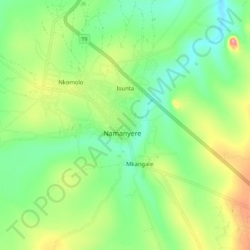
Name: Namanyere topographic map, elevation, terrain.
Location: Namanyere, Nkasi, Rukwa, Südhochlandzone, Tansania (-7.54816 31.00657 -7.46816 31.08657)
Average elevation: 1,548 m
Minimum elevation: 1,501 m
Maximum elevation: 1,633 m