
Edewechterdamm topographic map
Interactive map
Click on the map to display elevation.
About this map
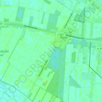
Name: Edewechterdamm topographic map, elevation, terrain.
Average elevation: 7 m
Minimum elevation: 3 m
Maximum elevation: 11 m
Other topographic maps
Click on a map to view its topography, its elevation and its terrain.
Pirgo
Deutschland > Niedersachsen > Landkreis Cloppenburg > Friesoythe > Altenoythe
Pirgo, Altenoythe, Friesoythe, Landkreis Cloppenburg, Niedersachsen, 26169, Deutschland
Average elevation: 8 m
Neuscharrel
Deutschland > Niedersachsen > Landkreis Cloppenburg > Friesoythe
Neuscharrel, Friesoythe, Landkreis Cloppenburg, Niedersachsen, 26169, Deutschland
Average elevation: 8 m
Mittelsten Thüle
Deutschland > Niedersachsen > Landkreis Cloppenburg > Friesoythe > Mittelsten Thüle
Mittelsten Thüle, Friesoythe, Landkreis Cloppenburg, Niedersachsen, 26169, Deutschland
Average elevation: 18 m
Neuvrees
Deutschland > Niedersachsen > Landkreis Cloppenburg > Friesoythe > Neuvrees
Neuvrees, Friesoythe, Landkreis Cloppenburg, Niedersachsen, 26169, Deutschland
Average elevation: 14 m
Altenoythe
Deutschland > Niedersachsen > Landkreis Cloppenburg > Friesoythe > Altenoythe
Altenoythe, Friesoythe, Landkreis Cloppenburg, Niedersachsen, 26169, Deutschland
Average elevation: 9 m