
Bagdad topographic map
Interactive map
Click on the map to display elevation.
About this map
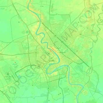
Name: Bagdad topographic map, elevation, terrain.
Location: Bagdad, بلدية المنطقة الخضراء, Gobernación de Bagdad, Irak (33.17976 44.18462 33.48683 44.57029)
Average elevation: 36 m
Minimum elevation: 26 m
Maximum elevation: 56 m
Other topographic maps
Click on a map to view its topography, its elevation and its terrain.
الكرخ
Irak > Gobernación de Bagdad > Bagdad
الكرخ, Bagdad, بلدية الكرخ, Gobernación de Bagdad, 10092, Irak
Average elevation: 38 m
Rashdiya
Irak > Gobernación de Bagdad > المسلخ
Rashdiya, المسلخ, ألأعظمية, Gobernación de Bagdad, Irak
Average elevation: 38 m