
御代田町 topographic map
Interactive map
Click on the map to display elevation.
About this map
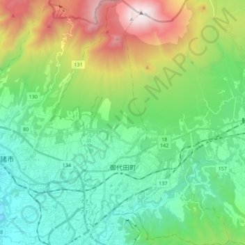
Name: 御代田町 topographic map, elevation, terrain.
Location: 御代田町, 北佐久郡, 長野県, 中部地方, 日本 (36.27963 138.45757 36.41393 138.57980)
Average elevation: 1,157 m
Minimum elevation: 599 m
Maximum elevation: 2,560 m
Other topographic maps
Click on a map to view its topography, its elevation and its terrain.