
Karavas topographic map
Interactive map
Click on the map to display elevation.
About this map
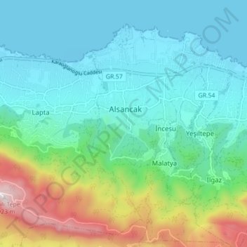
Name: Karavas topographic map, elevation, terrain.
Average elevation: 239 m
Minimum elevation: -1 m
Maximum elevation: 1,016 m
Other topographic maps
Click on a map to view its topography, its elevation and its terrain.
Kyrenia
Kyrenia, Girne Belediyesi, Girne (Kyrenia) District, Northern Cyprus, 99300, Cyprus
Average elevation: 89 m