

Tibet topographic maps
Click on a map to view its topography, its elevation and its terrain.


Nang County
Nang is located in the south-west of Nyingtri, at the middle and lower reaches of the Yarlung Tsangpo River. The county seat of Nang County is situated in a region resembling an elephant's trunk, leading to the metaphorical designation of this area as "Nang" which translates to elephant. The average altitude…
Average elevation: 4,608 m
Medog
China > Tibet > Mêdog County > Medog Township
Due to the large elevation difference in the terrain, there are obvious vertical climate changes in the mountains. The annual sunshine hours in Medog County are 1500.7 hours, and the annual average temperature in the valley area is 18°C–22°C. The average temperature in July is 25°C–28°C, and the…
Average elevation: 2,371 m


Nyalam
China > Tibet > Nyalam County > Nyalam
The other town of the county is Zhangmu, also known by its Tibetan name Dram, or Nepali Khasa. It is located near the border and is the point of entry from Nepal. At "merely" 2,300 meters elevation about the sea level, Zhangmu has mild and humid subtropical climate, which is a rarity for Tibet.
Average elevation: 4,756 m



Shigatse
Shigatse Peace Airport began operations on 30 October 2010 after an Airbus A319 landed safely, making it Tibet's fifth commercial airport. It is located 43 kilometres from Samzhubzê District at Jangdam Township at an elevation of 3,782 metres. The airport will be capable of supporting 230,000 passengers…
Average elevation: 4,049 m


Pangong Tso
China > Tibet > Rutog County
Pangong Tso or Pangong Lake (Tibetan: སྤང་གོང་མཚོ; Chinese: 班公错; pinyin: Bān gōng cuò; Hindi: पैंगोंग झील, romanized: Paiṅgoṅg jhīl) is an endorheic lake spanning eastern Ladakh and West Tibet situated at an elevation of 4,225 m (13,862 ft). It is 134 km…
Average elevation: 5,119 m

Nathu La
China > Tibet > Yadong County > Xiayadong
Nathu La is a mountain pass on the Dongkya Range that separates Sikkim and the Chumbi Valley at an elevation of 14,250 feet (4,340 m). The pass is 52–54 kilometres (32–34 mi) east of Gangtok, the capital of Sikkim, and 35 kilometres (22 mi) from Yatung Shasima, the headquarters of the Yadong County (or the…
Average elevation: 4,240 m



Gurla Mandhata
China > Tibet > Purang County > Purang
In 1905, T. G. Longstaff made an attempt on the west face of Gurla Mandhata with two alpine guides and six porters. After suffering a 900 feet (270 m) fall during an avalanche, they turned back around 7,000 m (23,000 ft) upon finding fresh snow was falling too heavily to reach the summit with their provisions.…
Average elevation: 6,913 m

Ngamring County
The office place of the county is located in Kagar, population 1,700, at an elevation of 4,380 m (14,370 ft).
Average elevation: 5,083 m


Lhasa
Lhasa prefecture-level city roughly corresponds to the basin of the Lhasa River, a major tributary of the Yarlung Tsangpo River. Exceptions are the north of Damxung County, which crosses the watershed of the Nyenchen Tanglha Mountains and includes part of the Namtso lake, and Nyêmo County, which covers the…
Average elevation: 4,866 m



Tuiwa
China > Tibet > Nakartse County > Daglung
Tuiwa (Chinese: 推瓦村; pinyin: Tuīwǎ Cūn; Tibetan: མཐུད་བ་གྲོང་ཚོ་, ZYPY: Tüwa Chongco) is a village located in Daglung [zh] Town, Nagarzê County, Shannan, Tibet, located at the northeast shore of Lake Puma Yumco. Tuiwa is the second highest permanent settlement by…
Average elevation: 5,039 m




Molamenqing
China > Tibet > Nyalam County > Yarlep
Molamenqing, also known as Phola Gangchen, is an eastern outlier of Shishapangma, the 14th-highest peak in the world. Both are in the Jugal Himal, a subrange of the Himalaya in Tibet. (This range is contiguous with, and often considered a part of, the Langtang Himal.) Its elevation is also given as 7,661 m…
Average elevation: 6,756 m

Riwoche County
Riwoche is the name of the county, the county capital, and the small village where the main monastery is located. Riwoche sits at around 3,400 m (11,200 ft) above sea level. The Dzi River flows through the region. The county grows barley and wheat. Khampa inhabitants of the area lives in houses made of wood.…
Average elevation: 4,389 m


Nam Tso
Namtso (Namco) is a lake that first formed during the Paleogene age, as a result of Himalayan tectonic plate movements. The lake lies at an elevation of 4,718 m (15,479 ft), and has a surface area of 1,900 km2 (730 sq mi). This salt lake is the largest lake in the Tibet Autonomous Region. However, it is not…
Average elevation: 4,920 m


Seni District
With an elevation of around 4,500 metres (14,800 ft), Nagqu has a harsh, alpine climate (Köppen EH), closely bordering on a subarctic climate (Dwc), with long, very cold and dry winters, and short, cool summers. In winter, temperatures frequently drop below −20 °C (−4 °F) at night and in summer…
Average elevation: 4,869 m
Shelkar
China > Tibet > Tingri County
The town lies 7 kilometres (4.3 mi) off the Friendship Highway between Lhatse and Tingri, at an altitude of about 4,300 metres (14,100 ft), at the southern foot of 5,260 metres (17,260 ft) high Gyatso La. It is approximately 60 kilometres (37 mi) north-west of Mount Everest and just over 50 kilometres (31 mi)…
Average elevation: 4,831 m
Tanggula Mountains
China > Tibet > Amdo County > Yanshiping Town
The elevations of the main ridge average over 5,000 m (16,404 ft). The Yangtze River originates in this mountain range; Geladandong, 6,621 metres or 21,722 feet high, located in Tanggula Town, is the tallest peak in the range.
Average elevation: 5,912 m


Nagqu City
Nagqu is located in the northeast of Tibet. Nagqu Town is 330 kilometres (210 mi) by the China National Highway 109 northeast of Lhasa. Nagqu is bordered by Bayingolin and Hotan Prefectures of Xinjiang to the north, Haixi, Yushu Prefectures of Qinghai and Chamdo to the east, Nyingchi, Lhasa and Shigatse to the…
Average elevation: 4,864 m




Yanshiping Town
China > Tibet > Amdo County
Yanshiping (Chinese: 雁石坪镇; pinyin: Yànshípíng zhèn) is a small town physically situated in the southwest of Qinghai province, China. However, it is under the jurisdiction of Amdo County in the Nagqu Prefecture of the Tibet Autonomous Region. At an elevation of 4,720 metres (15,490 ft), it is one of…
Average elevation: 4,958 m


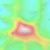
Mount Kailash
China > Tibet > Purang County > Darchen
Mount Kailash (also Kailasa; Kangrinboqê or Gang Rinpoche; Standard Tibetan: གངས་རིན་པོ་ཆེ; simplified Chinese: 冈仁波齐峰; traditional Chinese: 岡仁波齊峰; pinyin: Gāngrénbōqí Fēng; Sanskrit: कैलास, IAST: Kailāsa) is a mountain in Ngari Prefecture, Tibet…
Average elevation: 5,756 m


Yangbajain
The Yangbajain hot springs field is at an elevation of 4,290 to 4,500 metres (14,070 to 14,760 ft) which makes it the highest elevation set of hot springs in China, and possibly the world. The highest temperature inside the drilling hole is 125.5°C.
Average elevation: 4,448 m


Orba Co
China > Tibet > Rutog County > Dongru
Orba Co, also Wo Erba or Wo Erbacuo (Chinese: 窝尔巴错; pinyin: Wōěrbā cuò; Tibetan: འོར་པ་མཚོ, Wylie: 'or pa mtsho), is a lake in Rutog County in the Ngari Prefecture in the northwest of the Tibet Autonomous Region of China. It lies at an elevation of 5,209 metres (17,090 ft), to the southeast of Longmu Lake.
Average elevation: 5,246 m


Gonggar County
Gonggar County is located in southern Tibet and has a total area of 2,283 square kilometres (881 sq mi). The Yarlung Tsangpo River (Brahmaputra River), the mother river of Tibet, flows through the Gonggar County and among other counties of Shannan, and is thus rich in water resources. Set in west to east…
Average elevation: 4,378 m
Qüxü County
In the Tibetan language, the name means "water ditch." Qüxü County has a total area of 1,680 square kilometres (650 sq mi), with an average elevation of 3,650 metres (11,980 ft). The county is in the Yarlung Tsangpo valley, and is mostly relatively flat, but rises to the Nyainqêntanglha Mountains in the…
Average elevation: 4,514 m

Lhünzhub County
Lhünzhub County is situated in central Tibet, approximately 65 km (40 mi) northeast of Lhasa. The county encompasses the Pengbo River Valley and the upper reaches of the Lhasa River, covering an area of 4,512 km2 (1,742 sq mi). The region is geologically diverse, with an average elevation of 4,000 metres…
Average elevation: 4,634 m


Kawagarbo
China > Tibet > Chamdo City
The Meili Xue Shan has over 20 peaks with permanent snow cover, including six peaks over 6,000 m (19,700 ft). Topographic extremes are immense, with vertical relief ranging from less than 2,000 m along the Mekong River on the east to 6,740 m on the summit of Kawagarpo within 10 km horizontal distance. Even…
Average elevation: 5,809 m

Chengguan District
Lhasa is the second most populous urban area on the Tibetan Plateau after Xining and, at an altitude of 3,656 metres (11,990 ft), Lhasa is one of the highest cities in the world. The city has been the religious and administrative capital of Tibet since the mid-17th century. It contains many culturally…
Average elevation: 4,325 m