
Edavanakkad topographic map
Interactive map
Click on the map to display elevation.
About this map
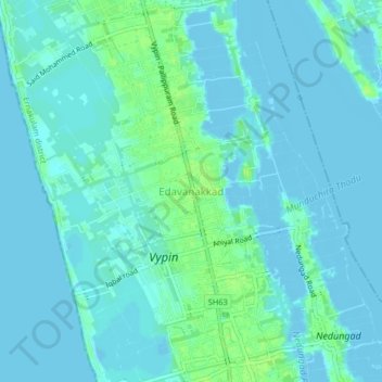
Name: Edavanakkad topographic map, elevation, terrain.
Location: Edavanakkad, Kochi, Ernakulam District, Kerala, 682502, India (10.06495 76.18892 10.10495 76.22892)
Average elevation: 3 m
Minimum elevation: -4 m
Maximum elevation: 12 m
Other topographic maps
Click on a map to view its topography, its elevation and its terrain.