
Thank you for supporting this site ❤️
Make a donation
Make a donation
Willingdon Island topographic map
Click on the map to display elevation.
Thank you for supporting this site ❤️
Make a donation
Make a donation
About this map
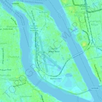
Name: Willingdon Island topographic map, elevation, terrain.
Location: Willingdon Island, Kochi, Ernakulam, Kerala, India (9.92480 76.25738 9.97083 76.29524)
Average elevation: 4 m
Minimum elevation: -3 m
Maximum elevation: 15 m
Thank you for supporting this site ❤️
Make a donation
Make a donation
Other topographic maps
Click on a map to view its topography, its elevation and its terrain.