
Jayakwadi Dam topographic map
Interactive map
Click on the map to display elevation.
About this map
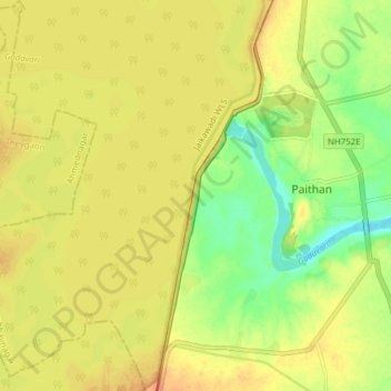
Name: Jayakwadi Dam topographic map, elevation, terrain.
Location: Jayakwadi Dam, Paithan, Aurangabad, Maharashtra, 431107, India (19.43591 75.35622 19.50847 75.37932)
Average elevation: 456 m
Minimum elevation: 431 m
Maximum elevation: 472 m
Other topographic maps
Click on a map to view its topography, its elevation and its terrain.