
Yumthang topographic map
Interactive map
Click on the map to display elevation.
About this map
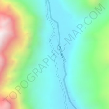
Name: Yumthang topographic map, elevation, terrain.
Location: Yumthang, Chungthang, Mangan, Sikkim, India (27.79426 88.69332 27.81426 88.71332)
Average elevation: 3,935 m
Minimum elevation: 3,589 m
Maximum elevation: 4,816 m
Other topographic maps
Click on a map to view its topography, its elevation and its terrain.