
Shangus topographic map
Interactive map
Click on the map to display elevation.
About this map
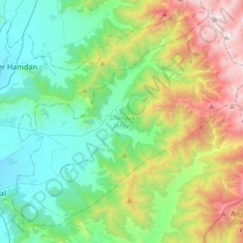
Name: Shangus topographic map, elevation, terrain.
Location: Shangus, Anantnag District, Jammu and Kashmir, India (33.65589 75.23729 33.83121 75.48144)
Average elevation: 2,451 m
Minimum elevation: 1,650 m
Maximum elevation: 4,389 m