
Shahdol topographic map
Interactive map
Click on the map to display elevation.
About this map
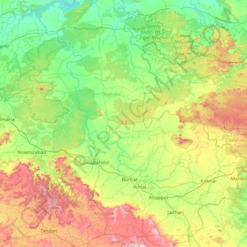
Name: Shahdol topographic map, elevation, terrain.
Location: Shahdol, Madhya Pradesh, India (22.86000 80.86000 24.14000 82.14000)
Average elevation: 527 m
Minimum elevation: 306 m
Maximum elevation: 1,168 m
Other topographic maps
Click on a map to view its topography, its elevation and its terrain.