
Ulhas River topographic map
Interactive map
Click on the map to display elevation.
About this map
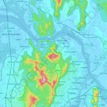
Name: Ulhas River topographic map, elevation, terrain.
Location: Ulhas River, Mira-Bhayander, Thane, Maharashtra, 401301, India (19.20006 72.82803 19.32627 73.02526)
Average elevation: 49 m
Minimum elevation: -3 m
Maximum elevation: 483 m
Other topographic maps
Click on a map to view its topography, its elevation and its terrain.