
Bonnet Plume River topographic map
Interactive map
Click on the map to display elevation.
About this map
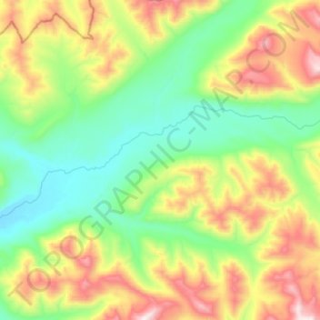
Name: Bonnet Plume River topographic map, elevation, terrain.
Location: Bonnet Plume River, Yukon, Canada (64.31468 -131.60857 64.35615 -131.32916)
Average elevation: 1,529 m
Minimum elevation: 1,181 m
Maximum elevation: 2,229 m
Other topographic maps
Click on a map to view its topography, its elevation and its terrain.
Dawson City
Canada > Yukon > Dawson City
Dawson City, Town of Dawson City, Yukon, Unorganized, Yukon, Canada
Average elevation: 510 m
Burwash Landing
Canada > Yukon > Burwash Landing
Burwash Landing, Yukon, Unorganized, Yukon, Y1A 3V4, Canada
Average elevation: 828 m