
Mullaitivu District topographic map
Interactive map
Click on the map to display elevation.
About this map
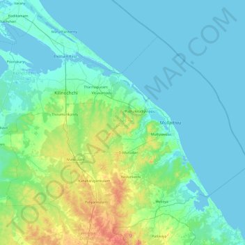
Name: Mullaitivu District topographic map, elevation, terrain.
Location: Mullaitivu District, Northern Province, Sri Lanka (8.93696 80.17503 9.60146 81.12709)
Average elevation: 22 m
Minimum elevation: -2 m
Maximum elevation: 161 m
Other topographic maps
Click on a map to view its topography, its elevation and its terrain.