
Vavuniya District topographic map
Interactive map
Click on the map to display elevation.
About this map
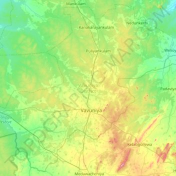
Name: Vavuniya District topographic map, elevation, terrain.
Location: Vavuniya District, Northern Province, 43000, Sri Lanka (8.54588 80.16893 9.12639 80.78702)
Average elevation: 71 m
Minimum elevation: 7 m
Maximum elevation: 243 m
Other topographic maps
Click on a map to view its topography, its elevation and its terrain.