
Achara topographic map
Interactive map
Click on the map to display elevation.
About this map
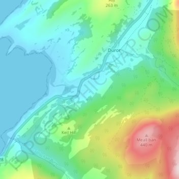
Name: Achara topographic map, elevation, terrain.
Location: Achara, Highland, Scotland, PA38 4DA, United Kingdom (56.61816 -5.30252 56.65816 -5.26252)
Average elevation: 115 m
Minimum elevation: -1 m
Maximum elevation: 473 m