
Anaimudi River topographic map
Interactive map
Click on the map to display elevation.
About this map
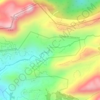
Name: Anaimudi River topographic map, elevation, terrain.
Location: Anaimudi River, Devikulam, Idukki, Kerala, India (10.16648 77.02523 10.16653 77.02533)
Average elevation: 1,915 m
Minimum elevation: 1,680 m
Maximum elevation: 2,173 m
Other topographic maps
Click on a map to view its topography, its elevation and its terrain.