
Thank you for supporting this site ❤️
Make a donation
Make a donation
Chokramudi topographic map
Click on the map to display elevation.
Thank you for supporting this site ❤️
Make a donation
Make a donation
About this map
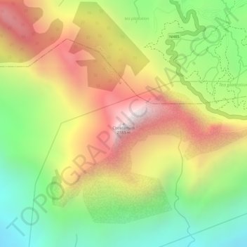
Name: Chokramudi topographic map, elevation, terrain.
Location: Chokramudi, Idukki, Kerala, 685613, India (10.03542 77.10572 10.03552 77.10582)
Average elevation: 1,670 m
Minimum elevation: 1,190 m
Maximum elevation: 2,146 m
Thank you for supporting this site ❤️
Make a donation
Make a donation
Other topographic maps
Click on a map to view its topography, its elevation and its terrain.
Thank you for supporting this site ❤️
Make a donation
Make a donation
Thank you for supporting this site ❤️
Make a donation
Make a donation