
Fontana topographic map
Interactive map
Click on the map to display elevation.
About this map
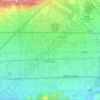
Name: Fontana topographic map, elevation, terrain.
Average elevation: 414 m
Minimum elevation: 257 m
Maximum elevation: 1,053 m
Other topographic maps
Click on a map to view its topography, its elevation and its terrain.
Upland
Vereinigte Staaten von Amerika > Kalifornien > San Bernardino County
Upland, San Bernardino County, Kalifornien, Vereinigte Staaten von Amerika
Average elevation: 457 m