
Khandala topographic map
Interactive map
Click on the map to display elevation.
About this map
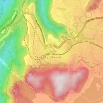
Name: Khandala topographic map, elevation, terrain.
Location: Khandala, Pune, Maharashtra, 410300, India (18.73599 73.35469 18.77599 73.39469)
Average elevation: 547 m
Minimum elevation: 134 m
Maximum elevation: 842 m
Other topographic maps
Click on a map to view its topography, its elevation and its terrain.