
Thank you for supporting this site ❤️
Make a donation
Make a donation
Omugakorongo topographic map
Click on the map to display elevation.
Thank you for supporting this site ❤️
Make a donation
Make a donation
About this map
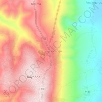
Name: Omugakorongo topographic map, elevation, terrain.
Location: Omugakorongo, Karagwe, Kagera, Lake Zone, Tanzania (-1.54010 31.13800 -1.50010 31.17800)
Average elevation: 1,457 m
Minimum elevation: 1,193 m
Maximum elevation: 1,664 m
Thank you for supporting this site ❤️
Make a donation
Make a donation
Other topographic maps
Click on a map to view its topography, its elevation and its terrain.