
Thank you for supporting this site ❤️
Make a donation
Make a donation
Ahmadpur topographic map
Click on the map to display elevation.
Thank you for supporting this site ❤️
Make a donation
Make a donation
About this map
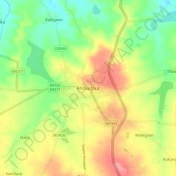
Name: Ahmadpur topographic map, elevation, terrain.
Location: Ahmadpur, Latur District, Maharashtra, 413515, India (18.66612 76.89773 18.74612 76.97773)
Average elevation: 513 m
Minimum elevation: 469 m
Maximum elevation: 563 m
Thank you for supporting this site ❤️
Make a donation
Make a donation