
Romsée topographic map
Interactive map
Click on the map to display elevation.
About this map
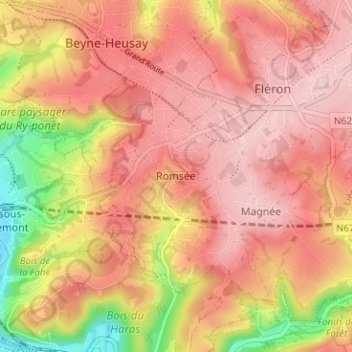
Name: Romsée topographic map, elevation, terrain.
Location: Romsée, Liège, Wallonie, 4624, Belgique (50.58692 5.64583 50.62692 5.68583)
Average elevation: 203 m
Minimum elevation: 71 m
Maximum elevation: 270 m