
Nennhausen topographic map
Interactive map
Click on the map to display elevation.
About this map
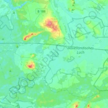
Name: Nennhausen topographic map, elevation, terrain.
Location: Nennhausen, Havelland, Brandenburg, Deutschland (52.53457 12.37787 52.63909 12.62071)
Average elevation: 33 m
Minimum elevation: 22 m
Maximum elevation: 92 m
Other topographic maps
Click on a map to view its topography, its elevation and its terrain.
Schönwalde-Glien
Deutschland > Brandenburg > Havelland
Schönwalde-Glien, Havelland, Brandenburg, 14621, Deutschland
Average elevation: 39 m